Complete Streets, Bicycle and Pedestrian Plans
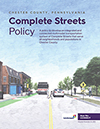 Chester County Complete Streets Policy
Chester County's Complete Streets Policy provides guidance for how streets may be planned, designed, retrofitted, and maintained to facilitate travel in a safe, convenient, and comfortable manner for all users regardless of their transportation mode. A complete street is more than adding facilities to accommodate pedestrians. Complete streets in Chester County represent an updated method of thinking about how our roadway corridors are utilized. View Policy
 Phoenixville Multi-Modal Transportation Plan
The Phoenixville Region Multimodal Transportation Plan identifies potential capital improvements and programming initiatives to increase the safety and efficiency of the transportation network regardless of age, ability, or mode of travel. Learn More
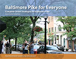 Baltimore Pike for Everyone — Complete Street Strategies
This plan aims to transform Baltimore Pike into a "complete street" by recommending improvements to increase the safety of any user regardless of their mode of travel, age, or ability. Baltimore Pike for Everyone includes recommendations for facility improvements, a review of each municipality's ordinances, a model complete streets resolution, and additional resources for implementing complete streets. View Document
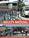 Multimodal Circulation Handbook for Chester County, PA
A consolidated reference guide on how to incorporate all transportation modes into contemporary land development site design. View Document
 Central Chester County Bicycle and Pedestrian Circulation Plan
The Chester County Planning Commission worked with seven municipalities to prepare a coordinated action plan to address transportation, public health, and the environment through improvements to walking, bicycling, and public transportation. The Central Chester County Bicycle & Pedestrian Circulation Plan identified "missing links" in the transportation systems plus cost estimates and priorities for implementation. The plan also made regulatory recommendations for local ordinances and official maps. View Plan

