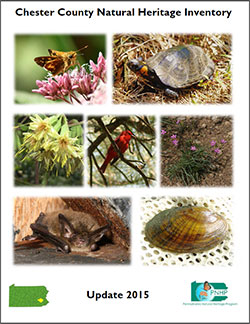
Chester County Natural Heritage Inventory
 The Chester County Natural Heritage Inventory 2015 presents extensive mapping and descriptions of the locations of what are commonly known as "threatened and endangered species" in Chester County. Technically speaking, these rare plants and animals are called "sensitive species" and include a variety of organisms that have been specially designated by state or federal agencies. The Inventory is useful to landowners who wish to know if sensitive species exist or are likely to exist on their property. Landowners who want to manage land or are developing their property may be required to document the presence or absence of sensitive species. View a list of sensitive species maintained by the Pennsylvania Natural Heritage Program.
The Inventory summary (the first Chapter of the Inventory) describes the methodology and also gives a listing of over 160 locations in Chester County which contain sensitive species. View the summary.
The Inventory was completed by staff of the Western Pennsylvania Conservancy following two years of research and field work. This effort was funded by the Pennsylvania Department of Conservation and Natural Resources as part of Pennsylvania Natural Heritage Program, a partnership which included the PA Game Commission and the PA Fish and Boat Commission. Staff from the CCPC also assisted in the preparation of the Inventory. Learn more about the Inventory's methodology.
The 2015 Inventory replaces the Chester County Natural Areas Inventory 1994 with 2001 Update. Since 2001, much more information has been gathered, so that the 2015 update is 606 pages long. View the entire document.
Mapping of Core Habitats and Supporting Landscapes
To discourage illegal collecting of endangered species, the mapping presented below provides generalized information about the species and natural communities that were identified as part of the Inventory. Municipal officials and other individuals who would like to acquire the available GIS shape file mapping of Core Habitats and Supporting Landscapes within Chester County should contact the Chester County Planning Commission.
The key terms you need to know when using the Inventory are:
- Natural Heritage Areas: The Core Habitat and the Supporting Landscape together make up a Natural Heritage Area. All the Natural Heritage Areas in Chester County are listed and described on pages 34 to 45 of the Inventory's summary which can be downloaded above.
- Core Habitats: Core Habitats are defined as "areas containing plant or animal species of concern at the state or federal levels, exemplary natural communities, or exceptional native diversity. Core habitats delineate essential habitat that cannot absorb significant levels of activity without substantial impact to the elements of concern." On the map to the below left, the Core Habitats are in dark green. On this map, each number refers to a unique "Core Habitat." View the Core Habitat map.
- Supporting Landscapes: Surrounding each core habitat is a "Supporting Landscape," which is presented in light green on the map to the below right. A Supporting Landscape is defined as "areas surrounding or contiguous to core habitats that maintain vital ecological processes or secondary habitat for sensitive natural features that may be able to accommodate some types of low-impact activities." In general terms, the Core Habitat is a location in which a species of concern is most likely to occur, while the Supporting Landscape is an area in which environmental damage could impact the Core Habitat. For example, a Core Habitat for a rare fish would be a stream, but pollution on the valley around the stream (the stream's Supporting Landscape) could impact the fish. View the Supporting Landscapes map.
Accessing Detailed Mapping and Information
Detailed information about Natural Heritage Areas in Chester County and all other counties in the state is available at a web page managed by the state-run Pennsylvania Natural Heritage Program (below left). This web page is updated on an ongoing basis, and gives the most recent information and mapping of Natural Heritage Sites through the Commonwealth (below right). Individuals interested in the most up-to-date and detailed information regarding the location of sensitive species should access this web page, and not rely solely on the 2015 Inventory which, over time, will become outdated.
Visit the Pennsylvania Natural Heritage Program website.
View mapping of Natural Hertiage Sites through the Commonwealth.

