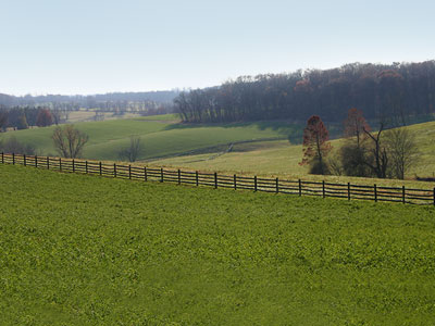
Preserving steep slopes protects the character of Chester County's rolling hills and maintains the unique sense of place of the region.
How it Works
Preservation and management of steep slopes allows a municipality to protect areas of steep and moderate slopes from disturbance that may cause erosion and flooding, as well as negatively impact water quality, wildlife habitat, slope stability, and scenic views.
Steep slopes are defined at the municipal level through municipal regulatory ordinances. Steep slope percentage thresholds for conservation vary by municipality, but generally begin at 15%. Many municipalities distinguish between "moderately steep slopes" of 15-25% and slopes defined as "very steep", "prohibitive", or "severely steep" as slopes greater than 25%. Stricter limits for defining steep slopes may apply to areas with specific geographic or geological constraints.
A variety of approaches to steep slope management are available to local governments. Applicable to all of Chester County's landscapes, municipalities with slope areas within their boundaries should consider developing and regularly updating slope protection regulations. Such regulations are generally located in both zoning and subdivision and land development ordinances. Land management and zoning tools such as "netting out" steep slopes from lot area and density calculations and regulating the disturbance of steep slopes can be incorporated into local zoning and subdivision and land development ordinances.
Benefits
Increased Stream Quality and Improved Stormwater Management
The preservation of steep slopes reduces erosion, sedimentation of nearby streams, and related downstream flooding, which serves to maintain and restore water quality in the region.
Scenic Viewshed Preservation
The Chester County landscape is defined by its rolling hills and picturesque viewsheds. Preserving steep slopes protects the character of the landscape and maintains the unique sense of place of the region.
Improved Slope Stability and Minimized Risk
The development or degradation of steep slopes may result in slope instability and potential loss of life and property; appropriate preservation and management of steep slopes minimizes such risk.
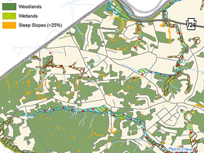
The North Coventry Township Comprehensive Plan includes an inventory of steep slope areas in the municipality.
Get Started
Provisions for slope management are typically included in both the municipal zoning ordinance and the subdivision and land development ordinance. The steps for a municipality to consider when implementing steep slope protection include:
Establish Policy
Prior to provisions being drafted for steep slopes, a policy basis for environmental protection policies, including slope management should be established within the municipal comprehensive plan and/or open space and environmental resources plan. Policy recommendations for the protection of slopes, including guidance on how they will be protected through the application of ordinance standards, should be developed.
Resource Inventory
The policy plan should include an inventory which defines steep slopes and maps known steep slope areas in the municipality. The steep slopes mapping provides guidance for determining which areas are most appropriate for growth and preservation. Areas of the municipality containing steep slopes should be designated for preservation wherever possible.
Develop and Adopt Ordinance Standards
After a policy basis is established, a municipality should amend its zoning ordinance to include steep slope permitted land use activities and maximum disturbance provisions. The subdivision and land development ordinance should also be amended to ensure that slopes are identified and mapped during the development review process and that disturbance of slopes during the construction process is managed to minimize erosion and sedimentation.
Most municipalities distinguish between "moderately steep slopes" of 15% to 25% and "severe", "prohibitive", or "very steep slopes" of greater than 25% slope. Municipal ordinances should require land development applicants to identify steep slope areas in a site plan and demonstrate how such areas will be protected from disturbance, or where disturbed, how such disturbance will be mitigated.
Suggested limits are no more than 30% disturbance of moderately steep slope areas (slopes with a grade of 15% to 25%) and no more than 15% disturbance of very steep slope areas (slopes with a grade of >25%).
Zoning Considerations: Zoning ordinances can protect steep slopes in a number of ways. Beyond the natural resource protection standards listed above, municipalities can implement zoning to set development patterns that further encourages natural resource protection. For example, cluster zoning, or Transfer of Development Rights (TDR) are suggested methods of protecting steep slopes by directing growth toward land most suitable to be developed while preserving areas of land containing high value natural resources.
Review Established Standards
For municipalities with steep slope standards already in place, a full review of regulatory standards should be undertaken to determine the best approach for updating or expanding the steep slope standards to be compliant with current environmental best practices. Depending on the strength of current standards, amendments to fill in the gaps and add more specific protection criteria may be all that is required. Otherwise, a full update and reorganization of the protection standards may be needed.
Ordinance Organization
A well organized ordinance makes it easier to enforce the provisions, avoid inconsistencies, and provide a clearer understanding of resource protection requirements for municipal officials, landowners, and developers. The most efficient means of organizing natural resource standards in municipal regulations is to include an umbrella approach to natural resources addressing steep slopes as well as wetlands, woodlands, and riparian buffers in a single article of the ordinance. The steep slope protection standards should be placed in the natural resource article addressing other resource protection standards, rather than in several different sections.
Considerations
Define Specific Standards
For steep slope regulations to be effective, specific regulations and land development standards need to be defined. For example, a clear definition for the method of measurement and calculation of slopes needs to be established. Language should be definitive in establishing maximum disturbance limits for steep slopes and care should be taken to avoid ambiguous language which may permit more disturbance of slopes than intended.
Items to be addressed in municipal regulations to avoid ambiguity may include: whether human-made slopes will be regulated, potential land development regulation exemptions for very minor or insignificant slopes, and permitted levels of disturbance and activities permitted within steep slope areas. Select activities may be permitted (or permitted by conditional use) in steep slope areas. Examples of these activities may include: passive parks and recreation, natural surface trails, location of utilities, or select agricultural uses.
Geographic Consideration
Stricter limits for permissible disturbance to steep slopes may apply to wooded slopes or slopes next to streams, or to areas with specific geographic or geological constraints such as the Cockeysville limestone formation located in southern Chester County. Greater restrictions can be defined and developed for these specific geographies.

East Bradford Township has established a steep slope conservation district in the zoning ordinance, which is an overlay to all other zoning districts.

London Grove Township has established a steep slope conservation district in the zoning ordinance, which is an overlay to all other zoning districts.
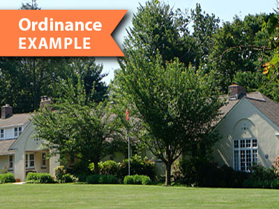
Pennsbury Township regulates steep slopes in a comprehensive natural resource protection article in their zoning ordinance.
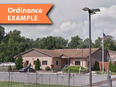
North Coventry Township regulates steep slopes in a comprehensive natural resource protection article in their zoning ordinances.
Model Resource Protection Ordinance
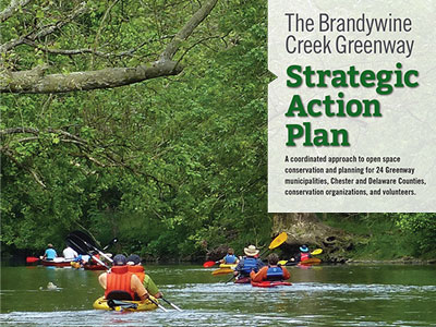
The Chester County Planning Commission partnered with the Brandywine Conservancy in 2015 to develop a set of natural resource protection standards to support the Conservancy's Brandywine Creek Greenway initiative. The Natural Resource Protection standards provide a template and background information for addressing natural resource protection through municipal ordinances. The model standards are located in The Brandywine Creek Greenway Strategic Action Plan Part 3 — Toolkit starting on page 327. Specific steep slope standards are located in the same document starting on page 333 .


